Glenfern Valley Bushlands
Management Plan
Prepared by
Robin Crocker & Associates
Biosis Research Pty Ltd
For
Department of Sustainability and Environment
Yarra Ranges Shire Council
February 2004


Glenfern Valley Bushlands
Management Plan - Draft
Prepared by
Robin Crocker
( 9830 2242
( 9646 9499
For
Department of Sustainability and Environment
Yarra Ranges Shire Council
Acknowledgments
We acknowledge the valuable comments and advice provided by members of the project steering committee, the Friends of Glenfern Valley Bushlands, and staff of the CFA, South East Water, Melbourne Water, Department of Sustainability Environment and Yarra Ranges Shire Council.
Photographs: Robin Crocker
This publication may be of assistance to you but the authors, Department of Sustainability and Environment and Yarra Ranges Shire Council do not guarantee that it is without flaw of any kind or is wholly appropriate for your particular purposes and therefore disclaims liability for any error, loss or other consequences which may arise from you relying on any information in this publication.
February 2004
glenfern mgt plan feb2.doc (figs 1-4 separate files)
Contents
1.2 Purpose of plan and process followed *
2 Analysis of current situation *
4 Vision, principles and goals *
4.1 Vision and future directions *
5.1 Goal 1: Protect and enhance natural values *
5.2 Goal 2: Provide safe and compatible recreation *
Appendix 1: Chronology of the reserve *
Appendix 2: State, regional and local strategies and plans *
Appendix 3: Ecological vegetation classes at Glenfern Valley *
Appendix 4: Existing conditions - management units *
Tables
Figures
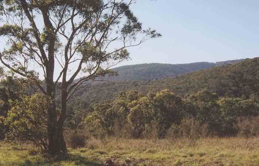
Located east of Melbourne in the Dandenong Ranges, Glenfern Valley Bushlands has important conservation values and opportunities to provide for a range of recreation activities in pleasant natural settings.
The reserve has suffered from neglect in the past and the Department of Sustainability and Environment (DSE) and the Shire of Yarra Ranges commissioned this plan to develop a vision, goals and actions to help ensure the sound future management of the 40-hectare reserve.
The plan was prepared by consultants working with staff from DSE, the Shire and other agencies and organisations, including the Friends of Glenfern Valley Bushlands. The planning process included assessments of the site and community consultation. Issues were reviewed, management options identified, goals, actions and priorities developed and management and monitoring requirements determined. Issues identified include damage and rubbish dumping resulting from illegal vehicle access, weed invasion, degraded tracks, a lack of facilities for passive recreation, and inadequate management resources.
|
The key goals identified for the study area are:
Major actions include
Indicative costs, responsibilities for management actions and sources of income are discussed. The planning process led to the development of a positive vision for Glenfern Valley Bushlands which sees ongoing enhancement of natural values and the provision of compatible informal recreational uses. |
 |
|
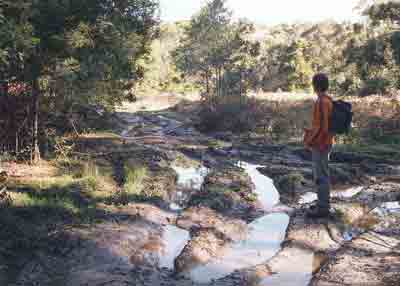
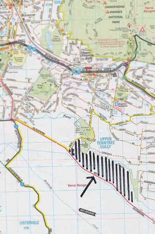
Glenfern Valley Bushlands is located 35 km east of Melbourne, south of Upper Ferntree Gully and the Dandenong Ranges National Park. The area is Unreserved Crown land and covers about 40 hectares between Glenfern Road and Ferny Creek in Yarra Ranges Shire (see map, right). The study area is adjacent to a Melbourne Water Retarding Basin on Ferny Creek, currently leased by an archery club, and Gilmour Park in the City of Knox. The study area also includes a fenced sewer access point in the south-east corner used by South East Water (figure 1 at end of report). These areas are discussed in the management plan where relevant to Glenfern Valley Bushlands. The reserve includes important natural values and has the potential to provide for a range of informal recreation opportunities. Parts of the reserve have been seriously degraded by past activities including quarrying and unregulated 4WD and trail bike access. A brief chronology of the history of the reserve is included in appendix 1. |
 |
1.2 Purpose of plan and process followed
This management plan was commissioned to enable future directions to be identified, and a vision, goals, actions and responsibilities determined. The plan included a review of priorities for conservation and recreation and the development of strategies to guide future planning and management.
The overall planning approach taken is as follows.
|
Review context, site values and uses |
è |
Identify key issues and mgt options |
è |
Vision Goals Mgt principles |
è |
Future Actions |
è |
Draft and final Strategy Report |
Preparation of the plan involved meetings with the project steering committee, discussions with stakeholders, distribution of newsletters, a community forum (see Site Analysis Report for details), several detailed site inspections and review of relevant documents and recent open space trends.
The plan was prepared by consultants under the direction of a steering committee with representatives from DSE, Yarra Ranges Shire Council and the Friends group.
1.3 State, regional and local context
A range of documents was reviewed to assist in developing the management plan. These included relevant State Government strategies, the Yarra Ranges Shire Planning Scheme and Open Space Strategy, a management plan for Gilmour Park (adjacent to the study area) and a waterway activity plan covering Ferny Creek.
The most relevant policies, strategies and plans are outlined in appendix 2.
1.4 Trends in use of parks and reserves
Some of the important trends likely to be relevant to the reserve are listed here. These are based on the outcomes of recent municipal park and open space studies undertaken in Victoria. See for example open space strategies for Knox, Frankston, Wellington and Macedon Ranges shires prepared by Robin Crocker and Associates.
Recreation/use
Conservation
Resources/management
2 Analysis of current situation
Existing recreational uses of the reserve include casual walking, dog walking, nature observation and sightseeing. No recreational facilities are provided except for walking tracks, many of which are poorly aligned and suffer from inadequate drainage and soil erosion.
The Sherbrooke Archers Club uses a large grassed area in the Melbourne Water retarding basin and substantial bushland areas above the basin and along Ferny Creek. These areas extend outside the Melbourne Water land into the reserve.
Illegal uses include 4WD and trail bike riding on and off existing tracks, and rubbish dumping. These activities have had significant impacts on the reserve.
The Friends group has recently been actively involved in assessing natural values and in weed control activities.
Flora and fauna values
The reserve supports at least seven fauna habitat types including Ferny Creek, Riparian Forest, Grassy Woodland, ephemeral wetland, planted native and exotic vegetation, weed thickets and predominantly introduced vegetation. The diversity of habitats, which vary in vegetation structure and composition, plays an important role in providing habitat for numerous native fauna species.
Four EVC’s (ecological vegetation classes) occur in the reserve (see appendix 3 for details):
The area has a high diversity of native species that occur in a range of habitats. There have been at least 111 documented fauna species (103 indigenous) recorded in or immediately adjacent to the reserve. These include at least 13 mammals (11 native), 88 bird species (82 native), seven native reptiles and three frog species.
Based on existing ecological information, Glenfern Valley Bushlands is at least regionally significant for biodiversity conservation. This implies that the site is significant on a regional scale, i.e. within the Highlands – Southern Fall Bioregion.
Pest plants and animals adversely affect the area’s natural values.
Cultural values
The reserve has moderate landscape values, providing an interesting contrast with rural landscapes in the adjacent Lysterfield Valley. There are no known sites of cultural significance in the reserve.
Natural and cultural values are discussed in detail in section 5.
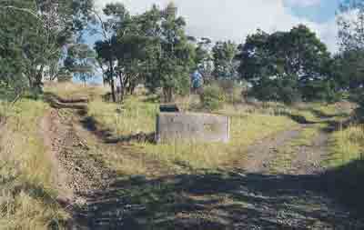
Site inspections and discussion were undertaken to identify existing conditions and the main issues facing the reserve (figure 1). Seven main management units were identified:
|
Unit No. |
Name |
|
1 |
Ferny Creek riparian strip |
|
2 |
Creek flats |
|
3 |
Grassy forest (west and central) |
|
4 |
Grassy forest (south-east) |
|
5 |
Grassy upper slopes |
|
6 |
Degraded upper slopes |
|
7 |
Former quarry site |
The management areas and associated issues are described in detail in appendix 4. Issues for many units related to weed invasion and the impacts of unregulated use and access.
There are several general issues that relate to more than one unit:
General issues
2.4 Existing management and resources
Glenfern Valley Bushlands is notionally managed by the Crown Land Management section of the Department of Sustainability and Environment (DSE) with support from the Friends of the Glenfern Valley Bushlands (the ‘Friends group’). The Shire of Yarra Ranges has also had some recent involvement, and is likely to assume management responsibility.
Specific management areas
Budget, assets and revenue
There is no annual budget allocation for the reserve, and no DSE staff member is currently responsible for day to day operations. No revenue is currently collected from users of the reserve.
The reserve does not have any significant equipment or other management assets.
The Friends group has recently been successful in obtaining some local sponsorship for their activities.
A SWOT analysis by the steering committee and subsequent analysis by the consultants identified the following strengths, weaknesses, opportunities and threats for the study area.
|
Strengths |
Weaknesses |
Opportunities |
Threats/constraints |
|
|
|
|
Important issues identified in the SWOT analysis, community forum and field assessments include:
These and other issues are discussed in detail in section 4.
|
Damage caused by 4WD vehicles and trail bikes . |
Excessive tracks and rubbish dumping . |
4 Vision, principles and goals
4.1 Vision and future directions
The following vision was developed for the study area.
In 2015, visitors to Glenfern Valley Bushlands find an attractive area with opportunities to relax and enjoy a mix of bushland areas ranging from riparian forest and wetlands along Ferny Creek to woodlands and grasslands on the slopes.
Viewing points, interpretive information and pleasant walking tracks and facilities help visitors to appreciate the area and reflect on the community’s changing attitude to the environment since the former quarry was closed in the 1980s. The reserve also provides an interesting visual contrast with the rural landscape in Lysterfield Valley across Glenfern Road.
Extensive weed control programs conducted by the Friends group and Council have had a remarkable effect on the health of the reserve with major weeds controlled and strong regeneration of the original vegetation communities. The exclusion of trail bikes and 4WD vehicles has ended rubbish dumping in the reserve and enabled eroded areas to recover.
Many walkers use the extensive track network in the Reserve and the linking tracks to Gilmour Park and Birds Land. The Archery Club continues to operate successfully on Melbourne Water and reserve land and makes an important contribution to weed control in the area.
In conjunction with Gilmour Park, Glenfern Valley Bushlands has become a well-known destination for people interested in enjoying quiet bushland and associated wildlife. The outstanding contribution of the Friends group and Council to rehabilitation of the reserve has been widely recognised by the local community and through several awards.
4.2 Planning and management principles
The following principles provide guidance for the future planning, design, development and management of the reserve. They have been developed from government strategies and other park and conservation studies and emphasise conservation and enhancement of flora and fauna, provision for compatible recreation and effective management and maintenance.
Conservation
Access and equity
Diversity, quality and design
Management and maintenance
These principles and strategies have been followed in developing goals and actions in this plan.
The key general goals identified for the study area are to:
The achievement of these goals is discussed in detail in section 5.
This section discusses issues in more detail and sets out the actions required to achieve the key goals. An overall action program is shown in section 6.
5.1 Goal 1: Protect and enhance natural values
Glenfern Valley Bushlands has important natural values requiring protection and enhancement.
Significance
Based on existing ecological information, Glenfern Valley Bushlands is at least regionally significant for biodiversity conservation. This implies that the site is significant on a regional scale, i.e. within the Highlands – Southern Fall Bioregion. Significant ecological features of the reserve include the presence of:
5.1.1 Vegetation
DSE classifies native vegetation in Victoria based on ‘ecological vegetation classes’ (EVCs). The reserve supports four EVC’s:
In addition there are areas of predominantly introduced vegetation, which are concentrated at the top of the site near Glenfern Road, on the alluvial flats near the Archery Club, and on the former quarry site in the centre of the reserve.
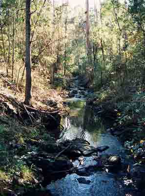
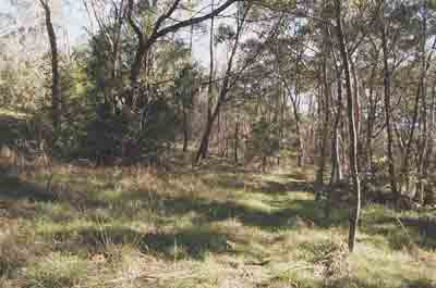
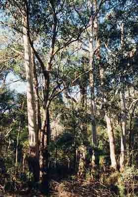
Valley Grassy Forest (above) and Riparian Forest (right)
Descriptions of the EVCs at Glenfern Valley are given in appendix 3.
The location of the EVC’s is shown on figure 2 and the quality of existing vegetation in figure 3.
The original (pre-1750) vegetation of the reserve is classified as Valley Grassy Forest, Herb-rich Foothill Forest and Riparian Forest in the mapping of Oates and Taranto (2001). This corresponds largely to the vegetation that is currently present on site. However, an area of Wetland Formation is also present on the alluvial flats associated with Ferny Creek. This wetland is likely to have been derived following clearing of trees and shrubs from this poorly-drained area.
The vegetation of the reserve has been surveyed by Biosis Research Pty. Ltd. and local naturalists from the Friends group, with the total number of recorded flora species currently standing at 241 (137 indigenous species, 104 introduced species). This number is likely to increase as further surveys are conducted within the reserve.
The quality of the vegetation is variable, ranging from relatively intact (low weed cover, all structural layers intact, close to natural species diversity) to highly modified (high weed cover, structurally modified, low species diversity). The Riparian Forest is generally in good to very good condition, while the Valley Grassy Forest on the slopes ranges from poor to very good condition (where weed control works have been undertaken). The Herb-rich Foothill Forest is highly degraded by dense infestations of Sweet Pittosporum and Boneseed and is generally in poor to moderate condition, with few eucalypts remaining. The Wetland Formation is of poor to moderate condition. The quality of the vegetation can be improved in most areas, as has already been demonstrated through the successful Boneseed eradication program undertaken by the Friends group in selected areas.
None of the recorded plant species are rare or threatened in Victoria (DSE Flora Information System). At least 15 species are rare within the Highlands – Southern Fall Bioregion and accordingly have regional significance (see appendix 1).
Weeds
The reserve currently supports large areas dominated by introduced species. Current management aims to control the spread of weed species, which will help protect native flora and fauna species throughout the reserve, and facilitate the natural regeneration of locally indigenous species.
A large number of introduced species are present. The major woody weeds include species such as Boneseed Chrysanthemoides monolifera, Sweet Pittosporum Pittosporum undulatum, Sallow Wattle Acacia longifolia ssp. longifolia and Blackberry Rubus fruticosus spp. agg., while the dominant herbaceous weeds include Three-corner Garlic Allium triquetrum, Cocksfoot Dactylis glomerata, Cape Ivy Delairea odorata, Panic Veldt Grass Ehrharta erecta, English Ivy Hedera helix, Soursob Oxalis pes-caprae and Tradescantia Tradescantia fluminensis.
Weed control is now essential for protection of biodiversity. It should focus on:
A variety of control techniques including manual removal, selective herbicide application away from sensitive areas, and smothering, burning or scorching weed species should be considered during any weed control program.
Local context
Native vegetation within Glenfern Valley Bushlands forms part of an isolated remnant of native vegetation bounded by residential subdivision and pasture, approximately 1 kilometre south of the Dandenong Ranges National Park. Based on DSE vegetation mapping, the proposed reserve includes about one-third of this remnant vegetation, with most of the remainder occurring on private land to the north of Ferny Creek, where it receives little or no conservation management.
Although the Glenfern Valley isolate is surrounded by residential areas and cleared farmland, it should be viewed in the context of a local patchwork of fragmented native vegetation, with only the Dandenong Ranges National Park to the north and Lysterfield Lake Park to the south being relatively extensive. Glenfern Valley Bushlands contributes to local and regional biodiversity by providing habitat for the flora and fauna it currently supports, and by providing potential or temporary habitat for species capable of dispersing across the largely cleared surrounding landscape. It is likely to act as a ‘stepping stone’ between remnants, especially between the Dandenong Ranges NP to the north and Lysterfield Lake Park to the south. Its role as a ‘stepping stone’ would be particularly important for highly mobile species such as birds and bats. In addition, Ferny Creek not only provides important fauna habitat, but it facilitates the movement (dispersal corridor) of a diversity of terrestrial and aquatic fauna species.
Tree decline
The poor condition of many of the eucalypts within the lower and mid slopes is of concern, as many of the trees are dead or in decline. Possible reasons for the dieback include drought stress, possum browsing, Bellbird damage, infection with Cinnamon fungus Phytophthora cinnamomi, or a combination of any of the these factors. A forest pathologist would need to assess the site in order to determine the specific cause(s) of tree decline within the reserve.
Drought stress is known to have already had a negative impact on tree populations in the Dandenong Ranges following the serious drought experienced over the past number of years. This is likely to have been a contributing factor to eucalypt dieback across the site. Unfortunately, there is no known method of ameliorating the effects of drought stress on large trees such as eucalypts, particularly on such a large site.
Possum browsing may also be a contributing factor to the dieback. Young foliage is preferentially eaten, so that mature leaves are not replaced when they are shed or eaten. Death from repeated defoliation may take a few years. A possum need only spend one night per fortnight in an affected tree to eat the new leaves that have been produced and the tree eventually dies, usually with a small amount of foliage still attached (Jeff Yugovic pers. comm.).
Much of the reserve is heavily infested with Sweet Pittosporum. In Victoria, Ringtail Possum densities (animals/ha) can be several times higher where there is a dense shrub stratum (such as Sweet Pittosporum) which provides nest sites and allows possums to move between feed trees and avoid ground predators (Henry 1995). Possums are likely to travel from their nest sites within the Sweet Pittosporum area to their feeding area (dieback zone). The possum habitat will decline as the eucalypt feed trees are eventually killed.
The loss of eucalypts is preventable with appropriate management. This includes removal, or ecological burning, to control Sweet Pittosporum and reduce possum numbers, and isolating and guarding individual trees of particular value, such as very large or attractive trees.
Cinnamon fungus is a major cause of dieback in forests in Victoria. It is a soil-borne fungal pathogen that has probably been introduced to Australia since European settlement, and is readily spread by infected soil adhering to vehicles. Many native plant species are susceptible including a large number of tree species (Marks and Smith 1991).
Management policies
Management actions
Vegetation management actions are set out below for the seven management units (figures 1 and 4).
Ferny Creek riparian strip
Creek flats
Grassy forest (west & central)
Grassy forest (south-east)
Grassy upper slopes
Degraded upper slopes
Former quarry site
5.1.2 Fauna
A number of fauna surveys have been undertaken in the reserve. These surveys indicate the high diversity of native species that occur in a range of habitats. There have been at least 111 documented fauna species (103 indigenous, eight introduced) recorded in or immediately adjacent to the reserve. These include at least 13 mammals (11 native), 88 bird species (82 native), seven native reptiles and three frog species. A number of additional species recorded (Atlas of Victorian Wildlife unpub. data) within the local area (five kilometres surrounding the reserve) would also be expected to occupy habitats either as residents or visitors on a regular, irregular and vagrant basis.
The reserve provides suitable habitat for the state significant (Powerful Owl) and a number of regionally significant fauna species. One Platypus was recorded upstream of Gilmour Park (Doeg 1999 – One Platypus has been recorded upstream of Gilmour Park (Doeg 1999 in Melbourne Water 1999) in the vicinity of Glenfern Valley, but has not been sighted since.
Habitats
The reserve supports at least seven fauna habitat types including Ferny Creek, Riparian Forest, Grassy Woodland, ephemeral wetland, planted native and exotic vegetation, weed thickets and predominantly introduced vegetation.
The diversity of habitats, which vary in vegetation structure and composition, plays an important role in providing habitat for numerous native fauna species. For example, the relatively closed canopy along Ferny Creek provides suitable foraging and nesting habitat for a variety of bird species such as honeyeaters, whistlers, thornbills and fantails.
The presence of large remnant Manna Gums, many of which possess hollows of varying size, is also an important habitat feature for native fauna species including arboreal mammals (Common Ringtail and Brushtail Possums), and insectivorous bats. Hollows also provide nesting and roosting sites for native birds such as owls, parrots, cockatoos and ducks. Grassy Woodland located up slope from the creek typically comprises a dense sward dominated by native grass and sedge species, while fallen timber is also found scattered throughout, which provides habitat for a variety of native reptiles (lizards, snakes) and frogs (Common Froglet, Brown Tree Frog).
Areas within the reserve contain high levels of weeds and therefore, in many instances, possess relatively low habitat value for fauna. Nevertheless, numerous fauna species, particularly smaller passerine species (wrens, thornbills and firetails), utilise weed thickets for foraging and nesting purposes. However, over time, weedy areas should be gradually removed and replaced with locally indigenous species (preferably through natural regeneration), as this will provide additional habitat for a greater diversity of native fauna species. Furthermore, the complexity of habitat features within the reserve should be maintained and where possible enhanced, as this will benefit a wide range of fauna species.
Actions related to indigenous fauna are included under vegetation, above.
Pest animals
Currently, introduced species such as rabbits, foxes and cats (domestic and feral) are likely to compete with native wildlife for habitat resources within the reserve, or directly predate on native fauna. Unrestrained dogs are also likely to adversely affect wildlife in the reserve, and birds such as the Common Myna displace native species. Currently, introduced species within the reserve are not subject to control programs.
Management actions
The reserve has moderate landscape values with attractive views over remnant bushland, and more intimate views near the creek and in relatively intact woodland areas. Views over the site provide an interesting contrast with views from Glenfern Road to the south over semi-developed rural landscapes. The Glenfern Valley Bushlands and adjacent Lysterfield Valley are classified by the National Trust of Australia (Victoria).
Existing fences, eroded tracks, rubbish, dumped fill and old signs detract from landscape values. The works area surrounding the sewer access point is unsightly and would be enhanced with boundary planting and rubbish removal. All future works and structures should complement the semi-natural setting.
The location and design of all tracks needs to be reviewed and a network established which is compatible with landscape and natural values (section 5.2.3).
Attractive entry points would help to improve visual amenity and visitor experience.
Management policies and actions
5.1.4 Soils
The soils of the study area comprise relatively recent quaternary volcanics on the slopes, while the Ferny Creek valley is comprised of deep, fertile, alluvial sediments (Allaway 1997). Soil erosion is occurring in areas, particularly along tracks used by four-wheel drives and motorbikes.
Most tracks where soil erosion is occurring could be closed, rehabilitated and revegetated using natural regeneration and planting of site-indigenous species (see section 5.2.3, and Fig. 4 for proposed track network following track closures).
5.1.5 Water quality
Water in Ferny Creek upstream of the reserve has been identified as of poor quality due to overflow from septic tanks, high litter loads from stormwater and other factors (Melbourne Water, 1999).
Unrestricted four-wheel drive access across the creek (upstream from the archery club) is also acting to promote bank erosion and sedimentation in the creek. Action is needed to prevent this damage (section 5.2.1).
Management actions
5.1.6 Fire
Fire management in the reserve is a complex issue, owing to a number of factors, including: (a) the need to protect life and property from catastrophic fire, through fuel reduction burning and fire suppression activities; (b) the desire to maintain species diversity; and (c) the need to manipulate habitat for particular animal species. Within the reserve, each of these factors needs to be considered prior to establishing a fire management plan or conducting a prescribed burn.
Most of the reserve was burnt in 1962 and 1980 (Peter Marke pers. comm.).
The reserve has been largely untouched by fire for over 20 years, which has led to the development of a fairly dense understorey in some areas. An ecological burn would therefore be beneficial, to promote the regeneration of indigenous species, eliminate mature woody weeds, reduce fuel levels (and subsequently the overall fire hazard) and provide an opportunity for the Friends group to study and monitor plant regeneration following fire.
Ideally, landscapes should be burnt in a mosaic fashion, with the season, intensity, frequency and extent of fires being variable across the landscape. Owing to practical limitations and the size of the reserve, this would not be feasible. However, with the cooperation of the local CFA, an ecological burn in the reserve is likely to provide worthwhile benefits.
Some guidelines for an ecological burn within the reserve include:
Issues related to fire and public safety are discussed in section 5.2.4.
Management actions
5.1.7 Cultural heritage
There are no known sites of cultural significance in the reserve. Any Aboriginal sites are protected under Commonwealth and State legislation; Aboriginal Affairs Victoria can provide advice if any potential sites are identified.
The reserve illustrates changing attitudes to natural areas with exploitative uses being replaced by activities aimed at preserving natural and landscape values.
Management actions
5.2 Goal 2: Provide safe and compatible recreation
Unregulated use in the past has led to damage by vehicles and the creation of an unsustainable network of tracks in the reserve. With careful planning and sensitive management, Glenfern Valley Bushlands has the potential to provide for pleasant informal recreation in an attractive bushland setting.
5.2.1 Vehicle access and parking
Public access
Glenfern Valley is small for a conservation reserve and access for public vehicles is inappropriate except for parking adjacent to the boundary.
Active management will be needed to prevent illegal vehicle access in the future. Experience in parks and reserves managed by Parks Victoria and other agencies shows that a range of steps can be taken including robust fencing and gates, signs, education of users and 4WD and trail bike organisations, patrols by staff and the Police, and well publicised enforcement.
Cable fencing of road and creek boundaries is likely to be necessary where illegal access has occurred in the past. The present use of boulders and logs does not provide an adequate deterrent.
An assessment of entry and parking options for the reserve indicated that an area inside the reserve, adjacent to the present gate on Glenfern Road, is the best site, providing good line of sight for motorists, views, and a well-located starting point for walks. Space for about 15 cars and 1 or 2 buses is likely to be adequate in the short to medium term. The small carpark on the corner of Glenfern Road and New Road may be phased out after the new carpark is established.
Management access
Vehicle access will be required to parts of the reserve for management and CFA vehicles. Many existing tracks can be closed and rehabilitated (section 5.1.1), and erosion of steep sections reduced by diverting runoff from track surfaces. Fire access tracks need to meet CFA standards, ie have vegetation trimmed to allow vehicle access. Existing tracks have adequate surfaces for CFA use (Peter Marke pers. comm.). Secure gates will be required at key entry-exit points.
Slashing beside the fire access track adjacent to Glenfern Road appears to be excessive and should not exceed the requirements for fire protection.
Management actions
5.2.2 Informal recreation
While the reserve will provide a range of opportunities for informal recreation, potential activities are constrained by sensitive flora and fauna, erodible soils and the need to avoid conflicts between different types of users.
Walking, picnicking, sightseeing and nature observation are compatible with the protection of natural values. Horse riding, mountain bike riding and sporting activities are likely to have unacceptable impacts, and are adequately catered for elsewhere in the region.
The reserve is likely to be moderately popular as a visitor destination and facilities such as tables, seats and possibly a picnic shelter are appropriate. More intensive facilities such as toilets and barbecues could be considered in the long term, depending on demand.
Dogs can adversely affect wildlife and other users, and some regulation of access is appropriate, particularly in areas of high conservation value.
Information and interpretation services would assist visitors to appreciate the area (section 5.3.2)
Management actions
5.2.3 Walking tracks
Walking is the most popular recreational activity away from home and is now recognised as a valuable form of exercise. Opportunities for enjoyable walking should therefore be maximised in the reserve. There are several current constraints including steep slopes on many tracks, rough track surfaces, fallen vegetation and poor locations with respect to views and natural features.
Future walking tracks should provide visitors with opportunities to see the most intact parts of the reserve, particularly the woodland areas where weeds have been controlled and the riparian forest along the creek. Loop tracks and a linking track to Gilmour Park are also highly desirable. For people with limited mobility, parking in Gilmour Park and walking into the reserve along a track following Ferny Creek would provide a good experience.
Tracks retained for management access (section 5.2.1) should be available for walking, supplemented by new tracks which follow comfortable grades and provide access to attractive areas. A possible future slashed grass track is shown in figure 4. The alignment will need to be carefully assessed to minimise impacts on vegetation.
Interpretive information could be provided for a loop walk from the proposed carpark on Glenfern Road (section 5.3).
Tracks should be wide enough for two people to walk side by side, with stable gravel, earth or slashed grass surfaces. Basic drainage is desirable where track surfaces are likely to be eroded by runoff after rain. Clear track signs are important to help visitors orient themselves and select a preferred route.
Archery Club activities need to ensure safety of people walking along the track beside Ferny Creek, adjacent to the Club (section 5.2.4).
Management actions
5.2.4 Safety
The safety of visitors and other people on-site is a high priority. Possible risks identified include fire, the creek, falling limbs, steep and uneven ground, archery activities (section 5.2.5) and illegal vehicle use. Recreation facilities also involve some risks.
Action is needed to minimise these risks with emphasis placed on fire safety, regular inspection and maintenance, and high standards for new facilities. Adequately maintained fire access tracks are important to meet the objectives of Council’s Regional Fire Protection Plan (section 5.2.1).
Management actions
5.2.5 Archery club activities
The archery club – Sherbrooke Archers Inc. – has been actively using land adjacent to New Road and Ferny Creek for over 20 years. Much of the land used is in a freehold retarding basin owned by Melbourne Water, but use extends well outside this area into the reserve. The club has a lease with Melbourne Water, currently due for renewal.
Activities of the club have adversely affected indigenous understorey vegetation near the creek and weeds are a significant problem in bushland areas where a series of targets are located. Protection of the streamside environment and control of invasive weeds are desirable to improve natural values. This will require relocation of targets from land between the creek and the adjacent existing management/walking track.
Fencing of the archery area is inadequate in places and visitors to the area can easily enter the archery area, providing public safety issues (section 5.2.4). Public access along Ferny Creek is highly desirable to provide a link between the reserve and Gilmour Park (section 5.2.3).
A survey undertaken by DSE in September 2003 has clearly defined the freehold land and a possible lease area.
Management actions
5.3 Goal 3: Involve the community in the reserve
5.3.1 Community involvement
There has been little community involvement in the reserve until the recent formation of the Friends group. Excellent progress has since been made, particularly with rubbish removal, weed control and monitoring of flora and fauna. Ongoing involvement of the Friends and other volunteers is highly desirable to assist with management and related activities such as weed control and revegetation, monitoring flora and fauna, assisting with funding applications, preparing newsletters and interpreting the area’s values. Council and DSE could assist with technical support e.g. to guide vegetation management.
Archery club members benefit directly from their use of the reserve and can be expected to contribute more to its management (section 5.2.5).
5.3.2 Interpretation and education
Interpretation is an informal education activity designed to increase community understanding, appreciation and enjoyment of natural and cultural features. Interpretive opportunities in the reserves include basic interpretive signs and publications, guided walks and activity programs. Community involvement in the provision of these services is desirable and should be encouraged and supported. Potential themes to be interpreted include changing attitudes and uses of the land, and vegetation communities.
A self-guided looped nature walk would provide a focus for visitors, providing access to grassland, woodland and riparian areas and highlighting changes to the reserve, eg Aboriginal use, grazing, quarrying, neglect and, now, conservation and appreciation. The walk could link with Gilmour Park where detailed interpretive signs are provided.
An interpretive shelter could be installed near the proposed carpark once illegal access and vandalism have been substantially reduced.
Education activities could be encouraged particularly relating to flora and fauna and issues such as land and vegetation management. Local schools could be increasingly involved in revegetation, environmental monitoring and investigation of impacts on the reserve.
5.3.3 Promotion, activities and events
The health benefits of open space use are well established. There are opportunities to promote the reserve more actively through newspapers, Council publications (including the website), walking groups etc and encourage increased use for compatible activities and events. An occasional newsletter would help update users.
Annual or more frequent events could be organised to showcase recent improvements and promote increased volunteer support.
Management actions
5.4.1 Management responsibility and reservation
DSE has very little land management capability and the area has been largely unmanaged until the Friends group became involved recently. Future management by the Shire, as Committee of Management under the Crown Land (Reserves) Act 1978, is proposed as an outcome of the management planning process.
Experience in park and reserve management indicates that clear responsibility within Council for management of the reserve is essential for effective implementation of this plan and sound ongoing management. A close working relationship with the Friends group will also be important.
5.4.2 Leases and boundary issues
Several issues were identified (see DSE Plan NW/02.09.2003)
5.4.3 Management resources
Very few resources have been available for management of the reserve in the past. There is no plant and equipment or other assets available for management, and no operating budget.
The State Government and Council have each committed $50,000 for the preparation and implementation of this management plan. This will need to be supplemented by grants, lease payments, commercial sponsorship, employment programs and a modest ongoing budget for vegetation management and maintenance of the reserve.
Technical input is also important to ensure that management and volunteer activities are based on environmentally sound principles.
5.4.4 Sustainable management
Sustainable management principles should be applied to facilities and services in parks and reserves. These include minimising use of energy and non-renewable resources, recycling, providing effective waste treatment, having no adverse impact on ecological processes and maintaining compatible recreational and educational opportunities.
Energy use in the reserve is low and there are few opportunities to reduce this further. Encouraging visitors to take their rubbish home and recycle it will minimise resources needed to handle rubbish.
5.4.5 Performance criteria, monitoring and review
Effective management involves the monitoring of relevant performance criteria and ongoing review of plan implementation, future strategies and actions. Simple indicators should be monitored to assess financial performance and changes in environmental values and visitor use and satisfaction.
Suggested broad indicators are:
Overall
Financial
Environmental:
Visitors and facilities:
Management actions
6.1 Priority actions and responsibilities
Major actions, responsibilities and priorities are set out in table 1. Note that additional details for some actions are provided in section 5. Management policies are not listed in the table.
The priorities listed are to be used to guide the development of annual programs.
Table 1: Priority action program
|
Goal |
Action (not in priority order) |
Respon'y * |
Est. cost ** |
Priority *** |
|
5.1 |
Ferny Creek riparian strip |
|||
|
SYR |
$ |
** |
|
|
|
SYR, Friends, Archery club |
$ |
*** |
|
|
|
Archery club |
Ongoing |
||
|
Creek flats |
||||
|
|
SYR, Friends |
$ |
** |
|
|
|
SYR, Friends |
Ongoing |
||
|
Grassy forest (west & central) |
||||
|
|
SYR, Friends |
$ |
*** |
|
|
|
SYR, Friends |
Ongoing |
||
|
|
SYR, Friends |
** |
||
|
|
SYR |
$ |
*** |
|
|
Grassy forest (south-east) |
||||
|
|
SYR, Friends |
$ |
** |
|
|
Grassy upper slopes |
||||
|
|
SYR |
$ |
*** |
|
|
|
SYR |
$$ |
*** |
|
|
Degraded upper slopes |
||||
|
|
SYR |
$ |
*** |
|
|
|
SYR, Friends |
$$ |
* |
|
|
Former quarry site |
||||
|
|
SYR, Friends |
$ |
* |
|
|
|
SYR, Friends |
$ |
** |
|
|
Pest animals |
||||
|
|
SYR |
$ |
** |
|
|
Landscape values |
||||
|
|
SYR |
Ongoing |
||
|
|
SYR, Friends |
$ |
*** |
|
|
|
SYR, Friends |
$ |
*** |
|
|
|
SEW |
[SEW] |
*** |
|
|
Water quality |
||||
|
|
SYR |
** |
||
|
Fire |
||||
|
|
SYR, Friends |
$ |
* |
|
|
Cultural heritage |
||||
|
|
SYR, DSE |
Ongoing |
||
|
|
SYR, Friends |
* |
||
|
5.2 |
|
SYR |
$$$ |
*** |
|
|
SYR |
$$$ |
*** |
|
|
|
SYR, Friends |
$ |
*** |
|
|
|
SYR |
$$ |
*** |
|
|
|
SYR |
Ongoing |
||
|
|
SYR |
*** |
||
|
|
SYR, Friends |
$ |
** |
|
|
|
SYR, Friends |
$ $ |
*** |
|
|
|
SYR, Friends |
$ |
*** |
|
|
|
SYR, DSE |
$ |
*** |
|
|
|
SYR |
*** |
||
|
|
SYR |
Ongoing |
||
|
|
SYR, DSE, archery club |
[club] |
*** |
|
|
5.3 |
|
SYR |
*** |
|
|
|
SYR, Friends |
$ |
** |
|
|
|
SYR, Friends |
$ |
** |
|
|
|
SYR, Friends |
** |
||
|
5.4
|
|
DSE, SYR |
*** |
|
|
|
DSE, SYR |
*** |
||
|
|
DSE, SYR |
** |
||
|
|
DSE, SYR |
*** |
||
|
|
SYR, Friends |
Ongoing |
||
|
|
SYR, DSE |
Ongoing |
||
|
|
SYR, DSE |
* |
* SYR: Shire of Yarra Ranges, DSE: Dept of Sustainability and Environment, SEW: South East Water
** $ = < $2500, $$ = $2500-10,000, $$$ = > $10,000.
Assumes volunteer labour available (Friends, Archery Club etc) to assist with tasks including weed control, revegetation and rubbish removal. Does not include agency staff costs or ongoing (recurrent) tasks such as maintenance of visitor facilities.
*** ***: High (within 1-2 yrs), **: Medium (within 2 – 5 yrs), *: Low (3 – 10 yrs).
Henry, S. 1995. Common Ringtail Possum, in ‘Mammals of Victoria: distribution, ecology and conservation’ (ed. P.W. Menkhorst). Oxford University Press, Melbourne.
Knox City Council (Allaway, M.N. ed) 1997. A management plan for Gilmour Park at the Ferny Creek Retarding Basin, Upper Ferntree Gully. Knox City Council and Melbourne Water, Victoria.
Marks, G.C. & Smith, I.W. 1991. The Cinnamon fungus in Victorian forests: history, distribution, management and control, in Lands and forests bulletin 31. Department of Conservation and Environment, Victoria.
Melbourne Water. 1999. Corhanwarrabul Creek waterway management activity plan. Melbourne Water, Victoria.
NRE. 2002. Victoria's Native Vegetation Management: a framework for action. Department of Natural Resources & Environment, Victoria.
Oates, A. & Taranto, M. 2001. Vegetation mapping of the Port Phillip and Westernport region. Department of Natural Resources & Environment, Victoria.
See appendix 2 for additional references.
Personal communications
Peter Marke, CFA, September 11, 2003
Appendix 1: Chronology of the reserve
Notes prepared to provide an overview of the history of the reserve.
Based on sources provided by DSE and the Friends Group.
|
Date |
Information /Activity |
Source* |
|
1972 |
Letter from SRWSC to Albion Reid PL indicating support for extraction from Glenfern Rd quarry. |
1 |
|
1973 |
Agreement between SRWSC and Albion Reid for quarrying of land. |
1 |
|
1973 |
Council report suggests use of area for passive recreation including water features, fauna park, kiosk, barbecues and revegetation |
1 |
|
1973 |
Shire drawing shows proposed Archery area and DVA retarding basin landscaping (Gilmour Park) |
1 |
|
1984 |
Reserve burnt except New Rd area |
2 |
|
1986 |
Shire letter to Bayview Quarries refers to proposed transfer of land to government for open space/recreation. Proposes replanting of area in accord with landscape plan. |
1 |
|
1986 |
Shire indicates interest in managing area for public purposes |
1 |
|
1986 |
Shire directs Bayview Quarries to remove waste material (area used as ‘Junk Yard’). |
1 |
|
1986 |
CFL notes indicate Boral may not have to undertake rehabilitation works |
1 |
|
1987 |
Council supports management by CFL; is strongly opposed to trail bike riding in area. |
1 |
|
1987/88 |
Land surrendered by Bayview Quarries to Crown. Formalised 8/88. Land contained in F.C.T Vol 8333 Fol 079 and F.C.T Vol 8116 Fol 814 |
1 |
|
1988 |
Council considering use of part of site for oval and sports stadium |
1 |
|
1997 |
NRE assessment of area discusses issues and identifies upper part of area as surplus. |
1 |
|
1998 |
Private subdivision proposal identifies areas suitable for development. |
1 |
|
1998 |
NRE notes that area is becoming degraded. Originally acquired for regional open space but Parks Victoria and Shire not interested in management. |
1 |
|
1999 |
Proposal by NRE to sell 16 ha of land above 155m contour – assessed as surplus. |
1 |
|
1999 |
Council prefers all or part of area to be retained for public use. Further subdivision not supported. (Did not proceed because of community concerns.) |
1 |
|
2001 (Aug) |
Proposal to establish 100 acre park and form Friends group. |
1 |
|
2001 (Sept) |
Public meeting supported preservation of land – about 80-100 attended |
1 |
|
2002 (Feb) |
Community and information day in reserve |
1 |
|
2002 (March) |
$3000 being spent by NRE on rubbish removal and weed control |
1 |
|
2002 (May) |
NRE works program prepared – costed at $10,000 plus Management Plan and Friends in-kind support. Includes details of weed control etc. |
1 |
|
2002 (May) |
Detailed paper to Council sets out options for area. Includes costed works program. Land zoned Public Park and Recreation Zone. Overlays apply? |
1 |
|
2002 (July) |
Application for NHT funding ($7000). |
1 |
|
2002 (Sep) |
NRE proposal estimates costs for priority works at $20,000 (fencing, weed control, rubbish removal, signs). |
1 |
|
2002 (Dec) |
Stated that DPI and Shire of Yarra Ranges each to contribute $50,000 for mgt plan and site management. Earlier notes indicate $20,000. Minister Garbutt had visited site and supported improved management. |
1 |
|
2003 (June) |
Management Plan commissioned by DSE and Shire of Yarra Ranges |
1 |
Sources
|
1 |
DSE Glenfern Road files (Box Hill office) |
|
2 |
CFA: Graham Brew, Peter Hall, 4-7-03 |
Appendix 2: State, regional and local strategies and plans
|
Document |
Content |
|
State |
|
|
Victoria’s Biodiversity – Our Living Wealth; Sustaining Our Living Wealth; Directions in Management, NRE 1997 |
Sets out a detailed strategy for maintaining biodiversity across the State, including protection of significant species and habitats. |
|
Victoria’s Native Vegetation Management – A Framework for Action, NRE, 2002 |
Sets out principles for vegetation protection and enhancement across Victoria (particularly on private land). Includes ‘Net Gain’ principle, which aims to avoid further vegetation losses, sets priorities for protection and describes methods to offset losses. |
|
Victorian Trails Strategy 2001-2004 (draft) Victorian Trails Coordinating Committee, 2001 |
This broad strategy provides details of existing trails, uses and benefits, and setting out a strategy for the future. Notes importance of short trails and attractive and diverse settings. Research indicates Victorians want trails with good surfaces, signs, information and services. Proposes well-managed major trails, completion of gaps and closing of trails that cannot be maintained. |
|
ERASS – the Exercise, Recreation and Sport Survey, Australian Sports Commission, 2001 |
Provides details of participation in sport and physical activities. Walking is the dominant physical activity (29% - plus 5% bushwalking), followed by swimming (16%) and aerobics/fitness (13%). |
|
Regional |
|
|
Linking People + Places – A strategy for Melbourne’s open space network, Parks Victoria, 2002 |
The strategy reviews existing regional open space, sets out the benefits of open space and principles for management, and recommends actions for future open space provision. The report focuses on regional open space and does not specifically mention Glenfern Valley. Relevant priority actions include conservation of natural values, trail links between open space areas and improved access, diversity and sustainability. A trail link is proposed between Lysterfield Lake Park and Belgrave via Birds Land Reserve, east of Glenfern Valley. |
|
Melbourne 2030: Planning for Sustainable Growth, DOI, 2002 |
The Reserve is outside the Urban Growth Boundary in this Strategy. |
|
Yarra Ranges Shire Planning Scheme and Municipal Strategic Statement (MSS) |
Refer Council web site. |
|
Open Space Strategy, Shire of Yarra Ranges, 1998 |
Includes strategic directions to provide diverse open space, protect natural environments, improve services, ensure sustainability, allocate more resources to less structured areas of open space and establish partnerships. Recommends retention of the study area for environmental protection and recreation. Recommends development of a trail along Ferny Creek (Upwey South Reserve to Gilmour Park). |
|
Local |
|
|
Corhanwarrabul Creek Activity Plan, Melbourne Water, 1999 |
Discusses values, issues and strategies for Ferny Creek and other waterways in area. Supports open space corridor upstream of Gilmour Park. Recommends weed control along creek, monitoring of bank erosion near archery club and removal of rubbish by club. Also discusses poor water quality in Ferny Creek, eg near Morris Rd. |
|
Management Plan for Gilmour Park, Knox City Council, 1997 |
Detailed plan setting out values, issues, actions and priorities for future management. Proposes cooperative management by the City, Melbourne Water and Shire of Yarra Ranges. Includes program to control off-road vehicles on adjacent land. Recommends dogs on leads only. |
Appendix 3: Ecological vegetation classes at Glenfern Valley
Descriptions of the EVCs at Glenfern Valley are given in the following table.
|
Ecological vegetation class |
Description |
|
Valley Grassy Forest |
Woodland to open forest on well-drained colluvial soils, with a diverse ground layer of graminoids and forbs. The overstorey is characterised by Bundy Eucalyptus goniocalyx, Narrow-leaf Peppermint E. radiata and Yellow Box E. melliodora in association with Black Wattle Acacia mearnsii and Cherry Ballart Exocarpos cupressiformis. The shrub layer is sparse, while the ground layer is characterised by Weeping Grass Microlaena stipoides, Kangaroo Grass Themeda triandra, Soft Tussock-grass Poa morrisii, Veined Spear-grass Austrostipa rudis, Bidgee Widgee Acaena novae-zelandiae, Creeping Bossiaea Bossiaea prostrata, Kidney-weed Dichondra repens, Pale Sundew Drosera peltata, Cranesbill Geranium spp., Pennywort Hydrocotyle spp., Small St John’s Wort Hypericum gramineum and Wattle Mat-rush Lomandra filiformis. Valley Grassy Forest occupies the north-east to north-west slopes of the reserve between Glenfern Road and Ferny Creek. |
|
Herb-rich Foothill Forest |
Woodland on well-drained soils in foothill areas, with a ground layer rich in herbaceous species. At the site, this EVC is dominated by a very sparse canopy layer of Swamp Gum Eucalyptus ovata and Narrow-leaf Peppermint, with the smaller trees, Black Wattle and Cherry Ballart common. The understorey is characterised by a range of graminoids and forbs including Weeping Grass, Kangaroo Grass, Common Maidenhair Adiantum aethiopicum and Kidney-weed. Herb-rich Foothill Forest occurs on the east-facing slopes in the east of the reserve between Glenfern Road and Ferny Creek. |
|
Riparian Forest |
Tall forest to 40 metres on deep fertile soils. The overstorey is dominated by Manna Gum Eucalyptus viminalis, over a secondary tree layer of Blackwood Acacia melanoxylon, Silver Wattle A. dealbata and Hazel Pomaderris Pomaderris aspera. The shrub layer is characterised by Snow Daisy-bush Olearia lirata, Prickly Currant-bush Coprosma quadrifida and Victorian Christmas-bush Prostanthera lasianthos, while the ground layer is dominated by Sword Tussock-grass Poa ensiformis, Weeping Grass, Common Maidenhair and Stinking Pennywort Hydrocotyle laxiflora. Riparian Forest occurs along Ferny Creek and the alluvial flats associated with the creek. |
|
Wetland Formation |
Freshwater Wetland on poorly drained areas, consisting of a mosaic of herbland/rushland/sedgeland. The vegetation is dominated by Austral Rush Juncus australis, Bidgee-widgee and Common Reed Phragmites australis. Wetland Formation occurs on the alluvial flat associated with Ferny Creek. |
Appendix 4: Existing conditions - management units
Details of conditions for the seven management units were as follows.
1 Ferny Creek riparian strip
This management unit incorporates Ferny Creek and the tall forest dominated by large, hollow-bearing Manna Gums, which occur along the length of the creek.
Issues
2 Creek flats
The alluvial flats associated with Ferny Creek incorporate a retarding basin managed by Melbourne Water, which is used by the Sherbrooke Archers Club. Prior to being cleared of trees, this area would have supported a tall forest dominated by Manna Gums and/or Swamp Gums. An area of Wetland Formation occurs at the eastern end of the creek flats.
Issues
3 Grassy forest (west & central)
This management unit incorporates remnant Valley Grassy Forest in poor to very good condition.
Issues
4 Grassy forest (south-east)
This management unit incorporates remnant Herb-rich Foothill Forest in poor to moderate condition.
Issues
5 Grassy upper slopes
This management unit predominantly comprises grassland dominated by a mixture of indigenous and exotic species.
Issues
6 Degraded upper slopes
This area is highly modified and devoid of native vegetation.
Issues
7 Former quarry site
This area is highly modified and devoid of native vegetation.
Issues
Appendix 5: Flora species list
Significance of species: R = Regional (Highlands Southern Fall Bioregion)
Note: All other indigenous species have local conservation significance
|
Significance |
Scientific name |
Common name |
|
Indigenous species |
||
|
Acacia dealbata |
Silver Wattle |
|
|
Acacia mearnsii |
Black Wattle |
|
|
Acacia melanoxylon |
Blackwood |
|
|
Acacia stricta |
Hop Wattle |
|
|
Acacia verticillata |
Prickly Moses |
|
|
Acaena novae-zelandiae |
Bidgee-widgee |
|
|
Acaena ovina |
Sheeps Burr |
|
|
Acrotriche prostrata |
Trailing Ground Berry |
|
|
Acrotriche serrulata |
Honeypots |
|
|
Adiantum aethiopicum |
Common Maidenhair |
|
|
Ajuga australis |
Austral Bugle |
|
|
Alisma plantago-aquatica |
Water Plantain |
|
|
Amyema pendula |
Drooping Mistletoe |
|
|
R |
Amyema quandang var. quandang |
Grey Mistletoe |
|
Arthropodium strictum |
Choclate Lily |
|
|
Asperula euryphylla |
Broad-leaf Woodrush |
|
|
Austrocynaglossum latifolium |
Forest Hound's Tongue |
|
|
R |
Austrodanthonia fulva |
Copper-awned Wallaby-grass |
|
Austrodanthonia laevis |
Wallaby Grass |
|
|
Austrodanthonia pennicillata |
Slender Wallagy Grass |
|
|
R |
Austrofestuca hookeriana |
Hooker Fescue |
|
Austrostipa rudis ssp. rudis |
Veined Spear-grass |
|
|
Billardia scandens |
Common Appleberry |
|
|
Bossiaea prostrata |
Creeping Bossiaea |
|
|
Burchardia umbellata |
Milkmaids |
|
|
Bursaria spinosa ssp. spinosa |
Sweet Bursaria |
|
|
Calochlaena dubia |
Common Ground-fern |
|
|
R |
Calystegia marginata |
Forest Bindweed |
|
Carex appressa |
Tall Sedge |
|
|
Carex breviculmis |
Short-stem Sedge |
|
|
Carex inversa |
Knob Sedge |
|
|
Carex spp. |
Sedge |
|
|
Cassinia aculeata |
Common Cassinia |
|
|
Cassinia longifolia |
Shiny Cassinia |
|
|
Centella cordifolia |
Centella |
|
|
Cheilanthes austrotenuifolia |
Rockfern |
|
|
R |
Cheilanthes sieberi ssp. sieberi |
Narrow Rock-fern |
|
R |
Chiloglottis valida |
Common Bird Orchid |
|
Clematis aristata |
Mountain Clematis |
|
|
Clematis microphylla |
Small Leaf Clematis |
|
|
Coprosma quadrifida |
Prickly Currant-bush |
|
|
R |
Cotula australis |
Common Cotula |
|
Cyathea australia |
Rough Tree Fern |
|
|
Daviesia latifolia |
Hop Bitter-pea |
|
|
Desmodium gunnii |
Southern Tick-trefoil |
|
|
Deyeuxia quadriseta |
Bent Reed Grass |
|
|
Dianella longifolia var. longifolia |
Pale Flax-lily |
|
|
Dianella revoluta s.s. |
Black-anther Flax-lily |
|
|
Dianella tasmanica |
Flax Lily |
|
|
Dichondra repens |
Kidney-weed |
|
|
R |
Doodia caudata |
Small Rasp-fern |
|
Drosera peltata |
Pale Sundew |
|
|
Drosera whittakeri ssp. aberrans |
Scented Sundew |
|
|
Echinopogon ovatus |
Forest Hedgehog Grass |
|
|
Epacris impressa |
Common Heath |
|
|
Epilobium billardierianum ssp. cinereum |
Grey Willow-herb |
|
|
Eragrostis brownii |
Common Love-grass |
|
|
Eucalyptus goniocalyx s.s. |
Bundy |
|
|
Eucalyptus melliodora |
Yellow Box |
|
|
Eucalyptus obliqua |
Messmate Stringybark |
|
|
Eucalyptus ovata |
Swamp Gum |
|
|
Eucalyptus radiata ssp. radiata |
Narrow-leaf Peppermint |
|
|
Eucalyptus viminalis ssp. viminalis |
Manna Gum |
|
|
Euchiton collinus |
Common Cudweed |
|
|
Euchiton spp. |
Cudweed |
|
|
Exocarpos cupressiformis |
Cherry Ballart |
|
|
Gahnia radula |
Thatch Saw-sedge |
|
|
Galium spp. |
Bedstraw |
|
|
Geranium potentilloides var. potentilloides |
Soft Cranesbill |
|
|
R |
Geranium sp. 2 |
Variable Cranesbill |
|
Geranium spp. |
Cranesbill |
|
|
Glycine clandestina |
Twining Glycine |
|
|
R |
Glycine microphylla |
Small-leaf Glycine |
|
Gonocarpus tetragynus |
Common Raspwort |
|
|
Goodenia ovata |
Hop Goodenia |
|
|
Gratiola peruviana |
Austral Brooklime |
|
|
R |
Gratiola pubescens |
Brooklime |
|
Gynatrix pulchella s.s. |
Hemp Bush |
|
|
Hydrocotyle laxiflora |
Stinking Pennywort |
|
|
Hydrocotyle spp. |
Pennywort |
|
|
Hypericum gramineum |
Small St John's Wort |
|
|
R |
Hypoxis vaginata |
Yellow Star |
|
R |
Juncus australis |
Austral Rush |
|
Juncus pauciflorus |
Loose-flower Rush |
|
|
Juncus planifolius |
Broad Leaf Rush |
|
|
Juncus procerus |
Tall Rush |
|
|
Kennedia prostrata |
Running Postman |
|
|
Kunzea ericoides |
Burgan |
|
|
Lagenophora spp. |
Bottle Daisy |
|
|
Lepidosperma elatius |
Tall Sword-sedge |
|
|
Lepidosperma laterale |
Variable Sword-sedge |
|
|
Leptospermum continentale |
Prickly Tea-tree |
|
|
Linum marginale |
Native Flax |
|
|
Lomandra filiformis |
Wattle Mat-rush |
|
|
Lomandra longifolia |
Spiny-headed Mat-rush |
|
|
Lythrum hyssopifolia |
Small Loosestrife |
|
|
Microlaena stipoides var. stipoides |
Weeping Grass |
|
|
Microtis unifolia |
Common Onion Orchid |
|
|
R |
Muellerina eucalyptoides |
Creeping Mistletoe |
|
Olearia argophylla |
Musk Daisy-bush |
|
|
Olearia lirata |
Snowy Daisy-bush |
|
|
Opercularia ovata |
Broad-leaf Stinkweed |
|
|
Oxalis perennans |
Yellow Wood-sorrel |
|
|
Oxalis spp. |
Wood Sorrel |
|
|
Ozothamnus ferrugineus |
Tree Everlasting |
|
|
Pandorea pandorana |
Wonga Vine |
|
|
R |
Pentapogon quadrifidus |
Five-awned spear Grass |
|
Persicaria decipiens |
Slender Knotweed |
|
|
Phragmites australis |
Common Reed |
|
|
Pimelea axiflora |
Bootlace Bush |
|
|
Pimelea humilis |
Common Rice-flower |
|
|
Plantago varia |
Plantain |
|
|
Poa ensiformis |
Sword Tussock-grass |
|
|
Poa labillardierei var. labillardierei |
Common Tussock-grass |
|
|
Poa morrisii |
Soft Tussock-grass |
|
|
Polyscias sambucifolia |
Panax Elderberry |
|
|
Polystichum proliferum |
Mother Shield-fern |
|
|
Pomaderris aspera |
Hazel Pomaderris |
|
|
Poranthera microphylla |
Small Poranthera |
|
|
Prostanthera lasianthos |
Victorian Christmas-bush |
|
|
Pteridium esculentum |
Austral Bracken |
|
|
Rapanea howittiana |
Muttonwood |
|
|
Rubus parvifolius |
Small-leaf Bramble |
|
|
Rumex brownii |
Swamp Dock |
|
|
Schoenus apogon |
Common Bog-sedge |
|
|
Senecio glomeratus |
Annual Fireweed |
|
|
Senecio minimus |
Shrubby Fireweed |
|
|
Senecio quadridentatus |
Cotton Fireweed |
|
|
Sigesbeckia orientalis ssp. orientalis |
Indian Weed |
|
|
Solanum prinoophyllum |
Forest Nightshade |
|
|
Solanum spp. |
Nightshade |
|
|
Tetrarrhena juncea |
Forest Wire-grass |
|
|
Thelymitra spp. |
Sun Orchid |
|
|
Themeda triandra |
Kangaroo Grass |
|
|
Trycoryne elatior |
Yellow Rush-lily |
|
|
Veronica calycina |
Hairy Speedwell |
|
|
Viola hederacea sensu Entwisle (1996) |
Ivy-leaf Violet |
|
|
Introduced species |
||
|
Acacia baileyana |
Cootamundra Wattle |
|
|
Acacia decurrens |
Early Black Wattle |
|
|
Acacia elata |
Cedar Wattle |
|
|
Acacia longifolia ssp. longifolia |
Sallow Wattle |
|
|
Acetosella vulgaris |
Sheep Sorrel |
|
|
Agapanthus praecox ssp. orientalis |
Agapanthus |
|
|
Agrostis capillaris var. aristata |
Browntop Bent |
|
|
Aira elegans |
Hair Grass |
|
|
Allium triquetrum |
Three-corner Garlic |
|
|
Anagallis arvensis |
Pimpernel |
|
|
Anthoxanthum odoratum |
Sweet Vernal-grass |
|
|
Arctotheca calendula |
Cape Weed |
|
|
Asparagus asparagoides |
Bridal Creeper |
|
|
Aster subulatus |
Aster-weed |
|
|
Avena fatua |
Wild Oats |
|
|
Briza maxima |
Large Quaking Grass |
|
|
Briza minor |
Quaking Grass |
|
|
Bromus catharticus |
Prairie Grass |
|
|
Centaurium erythraea |
Common Centaury |
|
|
Chamaecytisus palmensis |
Tree Lucerne |
|
|
Chenopodium album |
Sowbane |
|
|
Chrysanthemoides monilifera |
Boneseed |
|
|
Cichorium intybus |
Chicory |
|
|
Cirsium vulgare |
Spear Thistle |
|
|
Conium maculatum |
Hemlock |
|
|
Conyza albida |
Tall Fleabane |
|
|
Conyza spp. |
Fleabane |
|
|
Coprosma repens |
Mirror Bush |
|
|
Cordyline australis |
Cabbage Tree |
|
|
Cortaderia selloana |
Pampas Grass |
|
|
Cotoneaster pannosus |
Velvet Cotoneaster |
|
|
Crataegus monogyna |
Hawthorn |
|
|
Crocosmia x crocosmiiflora |
Montbretia |
|
|
Cupressus macrocarpa |
Monterey Cypress |
|
|
Cynodon dactylon var. dactylon |
Couch |
|
|
Cynosurus sp. |
Dog's Tail Grass |
|
|
Cyperus eragrostis |
Drain Flat-sedge |
|
|
Cytisus scorparius |
English Broom |
|
|
Dactylis glomerata |
Cocksfoot |
|
|
Daucus carota |
Carrot |
|
|
Delairea odorata |
Cape Ivy |
|
|
Echium plantagineum |
Paterson's Curse |
|
|
Ehrharta erecta var. erecta |
Panic Veldt-grass |
|
|
Erica lusitanica |
Spanish Heath |
|
|
Erigeron karvinskianus |
Seaside Daisy |
|
|
Euphorbia peplus |
Petty Spurge |
|
|
Foeniculum vulgare |
Fennel |
|
|
Fumaria muralis ssp. muralis |
Wall Fumitory |
|
|
Galium aparine |
Cleavers |
|
|
Gamochaeta purpurea |
Cudweed |
|
|
Genista linifolia |
Flax-leaf Broom |
|
|
Genista monspessulana |
Montpellier Broom |
|
|
Hedera helix |
English Ivy |
|
|
Helminthotheca echioides |
Ox-tongue |
|
|
Holcus lanatus |
Yorkshire Fog |
|
|
Hypochoeris radicata |
Cat's Ear |
|
|
Leontodon taraxacoides ssp. taraxacoides |
Hairy Hawkbit |
|
|
Lolium rigidum |
Wimmera Rye-grass |
|
|
Lotus spp. |
Trefoil |
|
|
Medicago arabica |
Spotted Medic |
|
|
Myoseris sylvatica |
Forget-me-not |
|
|
Narcissus tazetta |
Tazetta |
|
|
Oxalis corniculata s.s. |
Creeping Wood-sorrel |
|
|
Oxalis pes-caprae |
Soursob |
|
|
Paraserianthes lophantha ssp. lophantha |
Cape Wattle |
|
|
Paspalum dilatatum |
Paspalum |
|
|
Pelargonium X domesticum |
Regal Pelargonium |
|
|
Pennisetum clandestinum |
Kikuyu |
|
|
Pentaglottis sempervirens |
Alkanet |
|
|
Phalaris aquatica |
Toowoomba Canary-grass |
|
|
Pinus radiata |
Radiata Pine |
|
|
Pittosporum undulatum |
Sweet Pittosporum |
|
|
Plantago lanceolata |
Ribwort |
|
|
Plantago major |
Greater Plantain |
|
|
Poa annua |
Annual Meadow-grass |
|
|
Prunella vulgaris |
Self-heal |
|
|
Prunus cerasifera |
Cherry Plum |
|
|
Ranunculus repens |
Creeping Buttercup |
|
|
Raphanus raphanistrum |
Wild Radish |
|
|
Romulea rosea |
Onion Grass |
|
|
Rorippa nasturtium-aquaticum |
Watercress |
|
|
Rosa rubiginosa |
Sweet Briar |
|
|
Rubus fruticosus spp. agg. |
Blackberry |
|
|
Rumex conglomeratus |
Clustered Dock |
|
|
Salix spp. |
Willow |
|
|
Senecio vulgaris |
Common Groundsel |
|
|
Solanum mauritianum |
Wild Tobacco Tree |
|
|
Solanum nigrum s.s. |
Black Nightshade |
|
|
Sonchus asper s.s. |
Rough Sow-thistle |
|
|
Sonchus oleraceus |
Common Sow-thistle |
|
|
Sporobolus africanus |
Rat-tail Grass |
|
|
Stellaria media |
Chickweed |
|
|
Taraxacum officinale spp. agg. |
Garden Dandelion |
|
|
Tradescantia fluminensis |
Wandering Jew, Tradescantia |
|
|
Trifolium repens var. repens |
White Clover |
|
|
Trifolium spp. |
Clover |
|
|
Tropaeolum majus |
Nasturtium |
|
|
Verbena bonariensis s.s. |
Purple-top Verbena |
|
|
Viburnum tinus |
Laurestinus |
|
|
Vicia spp. |
Vetch |
|
|
Vinca major |
Blue Periwinkle |
|
|
Watsonia meriana var. bulbillifera |
Bulbil Watsonia |
|
|
Yucca gloriosa |
||
|
Zantedeschia aethiopica |
White Arum-lily |
Appendix 6: Fauna species list
Significance of species: R = Regional (Highlands Southern Fall Bioregion)
S = State
* = Introduced
Note: All other indigenous species have local conservation significance
|
Significance |
Common Name |
Scientific Name |
|
Mammal (native) |
||
|
Platypus |
Ornithorhynchus anatinus |
|
|
Short-beaked Echidna |
Tachyglossus aculeatus |
|
|
Common Brushtail Possum |
Trichosurus vulpecula |
|
|
Common Ringtail Possum |
Pseudocheirus peregrinus |
|
|
Sugar Glider |
Petaurus breviceps |
|
|
S |
Koala |
Phascolarctos cinereus |
|
Common Wombat |
Vombatus ursinus |
|
|
Black Wallaby |
Wallabia bicolor |
|
|
Eastern Grey Kangaroo |
Macropus giganteus |
|
|
Bush Rat |
Rattus fuscipes |
|
|
Swamp Rat |
Rattus lutreolus |
|
|
Mammal (introduced) |
||
|
* |
House Mouse |
Mus musculus |
|
* |
European Rabbit |
Oryctolagus cuniculus |
|
* |
Red Fox |
Canis vulpes |
|
* |
Cat (feral) |
Felis catus |
|
Birds (native) |
||
|
Little Pied Cormorant |
Phalacrocorax melanoleucos |
|
|
Silver Gull |
Larus novaehollandiae |
|
|
Australian White Ibis |
Threskiornis molucca |
|
|
White-faced Heron |
Egretta novaehollandiae |
|
|
Australian Wood Duck |
Chenonetta jubata |
|
|
Pacific Black Duck |
Anas superciliosa |
|
|
Brown Goshawk |
Accipiter fasciatus |
|
|
Collared Sparrowhawk |
Accipiter cirrhocephalus |
|
|
R |
Wedge-tailed Eagle |
Aquila audax |
|
R |
Little Eagle |
Hieraaetus morphnoides |
|
Black-shouldered Kite |
Elanus axillaris |
|
|
Peregrine Falcon |
Falco peregrinus |
|
|
Brown Falcon |
Falco berigora |
|
|
Southern Boobook |
Ninox novaeseelandiae |
|
|
S |
Powerful Owl |
Ninox strenua |
|
Rainbow Lorikeet |
Trichoglossus haematodus |
|
|
Musk Lorikeet |
Glossopsitta concinna |
|
|
R |
Little Lorikeet |
Glossopsitta pusilla |
|
Yellow-tailed Black-Cockatoo |
Calyptorhynchus funereus |
|
|
Gang-gang Cockatoo |
Callocephalon fimbriatum |
|
|
Sulphur-crested Cockatoo |
Cacatua galerita |
|
|
R |
Little Corella |
Cacatua sanguinea |
|
Galah |
Cacatua roseicapilla |
|
|
Australian King-Parrot |
Alisterus scapularis |
|
|
Crimson Rosella |
Platycercus elegans |
|
|
Eastern Rosella |
Platycercus eximius |
|
|
Tawny Frogmouth |
Podargus strigoides |
|
|
Australian Owlet-nightjar |
Aegotheles cristatus |
|
|
Laughing Kookaburra |
Dacelo novaeguineae |
|
|
Sacred Kingfisher |
Todiramphus sanctus |
|
|
White-throated Needletail |
Hirundapus caudacutus |
|
|
Pallid Cuckoo |
Cuculus pallidus |
|
|
Fan-tailed Cuckoo |
Cacomantis flabelliformis |
|
|
R |
Brush Cuckoo |
Cacomantis variolosus |
|
Horsfield's Bronze-Cuckoo |
Chrysococcyx basalis |
|
|
Shining Bronze-Cuckoo |
Chrysococcyx lucidus |
|
|
Welcome Swallow |
Hirundo neoxena |
|
|
Tree Martin |
Hirundo nigricans |
|
|
Fairy Martin |
Hirundo ariel |
|
|
Grey Fantail |
Rhipidura fuliginosa |
|
|
R |
Rufous Fantail |
Rhipidura rufifrons |
|
Willie Wagtail |
Rhipidura leucophrys |
|
|
Satin Flycatcher |
Myiagra cyanoleuca |
|
|
R |
Rose Robin |
Petroica rosea |
|
Eastern Yellow Robin |
Eopsaltria australis |
|
|
Golden Whistler |
Pachycephala pectoralis |
|
|
Rufous Whistler |
Pachycephala rufiventris |
|
|
Olive Whistler |
Pachycephala olivacea |
|
|
Grey Shrike-thrush |
Colluricincla harmonica |
|
|
Magpie-lark |
Grallina cyanoleuca |
|
|
Crested Shrike-tit |
Falcunculus frontatus |
|
|
Black-faced Cuckoo-shrike |
Coracina novaehollandiae |
|
|
Striated Thornbill |
Acanthiza lineata |
|
|
Brown Thornbill |
Acanthiza pusilla |
|
|
White-browed Scrubwren |
Sericornis frontalis |
|
|
Superb Fairy-wren |
Malurus cyaneus |
|
|
Dusky Woodswallow |
Artamus cyanopterus |
|
|
Varied Sittella |
Daphoenositta chrysoptera |
|
|
White-throated Treecreeper |
Cormobates leucophaeus |
|
|
Mistletoebird |
Dicaeum hirundinaceum |
|
|
Spotted Pardalote |
Pardalotus punctatus |
|
|
Silvereye |
Zosterops lateralis |
|
|
White-naped Honeyeater |
Melithreptus lunatus |
|
|
Eastern Spinebill |
Acanthorhynchus tenuirostris |
|
|
Yellow-faced Honeyeater |
Lichenostomus chrysops |
|
|
White-eared Honeyeater |
Lichenostomus leucotis |
|
|
White-plumed Honeyeater |
Lichenostomus penicillatus |
|
|
New Holland Honeyeater |
Phylidonyris novaehollandiae |
|
|
Bell Miner |
Manorina melanophrys |
|
|
Noisy Miner |
Manorina melanocephala |
|
|
Red Wattlebird |
Anthochaera carunculata |
|
|
Red-browed Finch |
Neochmia temporalis |
|
|
Pied Currawong |
Strepera graculina |
|
|
Grey Currawong |
Strepera versicolor |
|
|
Grey Butcherbird |
Cracticus torquatus |
|
|
Australian Magpie |
Gymnorhina tibicen |
|
|
R |
Bassian Thrush |
Zoothera lunulata |
|
Little Raven |
Corvus mellori |
|
|
Striated Pardalote |
Pardalotus striatus |
|
|
Birds (introduced) |
||
|
* |
Spotted Turtle-Dove |
Streptopelia chinensis |
|
* |
Rock Dove |
Columba livia |
|
* |
Common Blackbird |
Turdus merula |
|
* |
House Sparrow |
Passer domesticus |
|
* |
European Goldfinch |
Carduelis carduelis |
|
* |
European Greenfinch |
Carduelis chloris |
|
* |
Common Myna |
Acridotheres tristis |
|
* |
Common Starling |
Sturnus vulgaris |
|
Reptiles |
||
|
R |
Tree Dragon |
Amphibolurus muricatus |
|
Garden Skink |
Lampropholis guichenoti |
|
|
Weasel Skink |
Saproscincus mustelinus |
|
|
Common Blue-tongued Lizard |
Tiliqua scincoides |
|
|
Tiger Snake |
Notechis scutatus |
|
|
Lowland Copperhead |
Austrelaps superbus |
|
|
Frogs |
||
|
Common Froglet |
Crinia signifera |
|
|
Southern Brown Tree Frog |
Litoria ewingii |
Note: A number of additional species are likely to occupy habitats within Glenfern Valley Bushlands that have not been included above.